
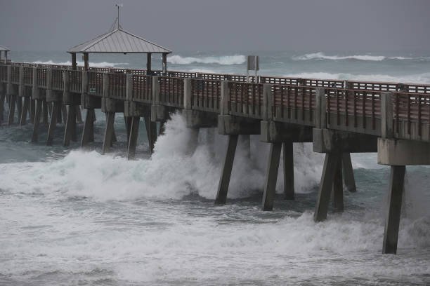
Isaias has weakened to a post-tropical cyclone after making landfall near Destin, Florida, as a Category 2 hurricane on Friday 9 October. Heavy rain and flooding remain a threat as the system moves inland.
The hurricane struck with maximum sustained winds of 105mph. By Saturday morning, winds had fallen to 35mph, according to the US National Hurricane Center.
Hundreds of thousands lose power
More than 726,000 electricity customers in Florida and Alabama were without power early Saturday, Associated Press reported, citing the outage tracker PowerOutage.us.
AP also reported flooded roads in Destin and police warnings about debris blocking streets in Pensacola. Parts of southern Alabama experienced flooding, with downed trees and power lines reported in Mobile.
The figures describe conditions early on Saturday, rather than a final account of the storm’s damage. The extent of the destruction was still being assessed.
AP’s report: https://apnews.com/article/hurricane-isaias-flooding-power-outages-65ac97bf16477d89ec6f847b09ccb6fc (apnews.com)
Weaker winds, continuing danger
In its final advisory, issued at 09:00 GMT on Saturday 10 October, the National Hurricane Center placed Isaias about 25 miles south-southwest of Montgomery, Alabama.
The centre discontinued all storm surge and tropical storm warnings. However, it warned that flash flooding, river flooding, and flooding in urban areas remained possible.
Forecasters expected four to eight inches of rain across southern Alabama, the Florida Panhandle and Big Bend, and south-west Georgia through the weekend. Some locations could receive considerably more.
There was also a risk of tornadoes across parts of the eastern Florida Panhandle, Georgia, and the Carolinas during Saturday.
What happens next
Isaias is forecast to move across Alabama towards the Tennessee Valley before dissipating on Sunday. Further updates will come from the US Weather Prediction Center.
Residents and travellers should continue checking local emergency instructions and weather alerts: falling wind speeds do not mean the flooding danger has passed.
Official advisory: https://prod-west-nhc.woc.noaa.gov/mobile/text/refresh/MIATCPAT4%2Bhtml/100843.shtml (prod-west-nhc.woc.noaa.gov)