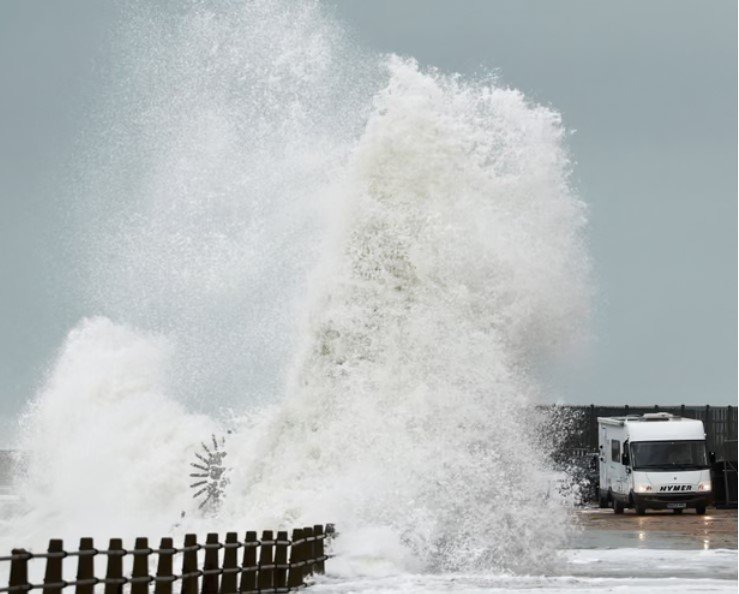
Britain is preparing for a second named storm In as many days, with updated warnings on Saturday, 24 October, for potentially damaging winds and heavy rain. The Met Office published a fresh forecast at 3 a.m. British time and updated its warnings later in the morning. It said Storm Boelo would approach north-western areas through Saturday, with the strongest conditions expected later in the day and overnight. The Guardian reported on Saturday that thousands of households were still recovering from Friday’s Storm Austen. The distinction matters: the forecast concerns Boelo’s expected impacts, not confirmed damage that has already occurred.
Where Are the Most Serious Warnings?
According to the Met Office, an amber wind warning covers parts of Scotland, northern England and Northern Ireland, with the most severe conditions forecast during Saturday evening and Sunday. The official warnings page, updated at 8:43 a.m. British time, indicates gusts widely reaching 60 to 70mph in the amber area and potentially 80mph along exposed coasts. Wider yellow warnings cover other areas affected by wind and rain. Warning boundaries and validity periods may change as the system moves, so residents should check the official warnings rather than rely on a static social-media graphic.
What Could Happen to Travel?
Sky News reported early Saturday that forecasters expected serious disruption across northern Britain as Boelo followed Friday’s storm. The Guardian said rail operators were urging passengers to consider whether journeys were essential, with TransPennine Express advising against non-essential travel and Avanti West Coast cautioning against travel north of Preston on Sunday. Ferries, flights, exposed roads, and bridges may also be affected. These warnings do not mean every service has been cancelled. Passengers should confirm individual journeys with operators before leaving, particularly if they need to make connections or travel to work.

Are Power Cuts Already Being Reported?
The Guardian reported that more than 3,700 properties in south-west England remained without electricity on Saturday morning after Storm Austen, following a peak of about 31,000 affected properties on Friday. Those figures relate to the previous storm, not to new damage caused by Boelo. The Met Office warns that the approaching winds could trigger further power cuts, potentially affecting mobile phone coverage and other services. Reporting must keep those two situations separate: existing outages from Austen are verified, while additional outages from Boelo remain a forecast risk at the time of writing.
How Are Local Authorities Preparing?
Aberdeenshire Council warned on Friday that fallen trees, coastal waves, debris and localised flooding could affect residents through the weekend. It said teams would monitor conditions and respond where safe, and it advised people to secure loose outdoor objects and avoid dangerous coastal paths. The council also highlighted the possibility of disruptions to power, roads, and public transport. Its warning predates Saturday, but it supplies useful local context for the updated national forecast. Residents should use local council notices alongside national weather alerts, particularly for information about school, road, or community-service closures.
What Should Residents Do Before the Storm Peaks?
The Met Office advises caution around exposed roads, coastlines and areas with falling branches or flying debris. Anyone who must drive should reduce speed, allow more space around large vehicles, and avoid unnecessary journeys in the most affected areas. Households can charge essential devices, secure bins and garden furniture, and prepare for possible short-term disruption. People requiring electricity for medical equipment may need to contact their provider or support network in advance. Safety guidance is precautionary; it should not be presented as proof that a particular household will lose power or be evacuated.
Why Does This Matter Beyond the Weather Forecast?
Storm Boelo comes immediately after Austen caused significant disruption in the south-west, leaving limited time for repairs and recovery before another system reaches Britain. For workers, students, families, and migrant communities, interrupted transport can mean missed shifts, disrupted appointments, and unexpected accommodation costs. However, the severity will vary by location. A national warning is not a substitute for postcode-level advice, and readers should avoid assuming that all of the United Kingdom faces the same danger. The most useful reporting will track verified closures, outage figures, and transport updates as conditions change.
What Happens Next?
The most important period is Saturday evening into Sunday, when forecasters expect the strongest gusts across parts of the north. Editors should monitor the Met Office’s official warnings, transport operator statements, National Grid outage information and local authority updates before publication. Any confirmed injuries, cancellations, or new power cuts should be attributed to a named authority and timestamped. As of this handover, the key new development is Saturday’s updated warning and the approaching storm; widespread damage from Boelo should not be described as an established fact.